


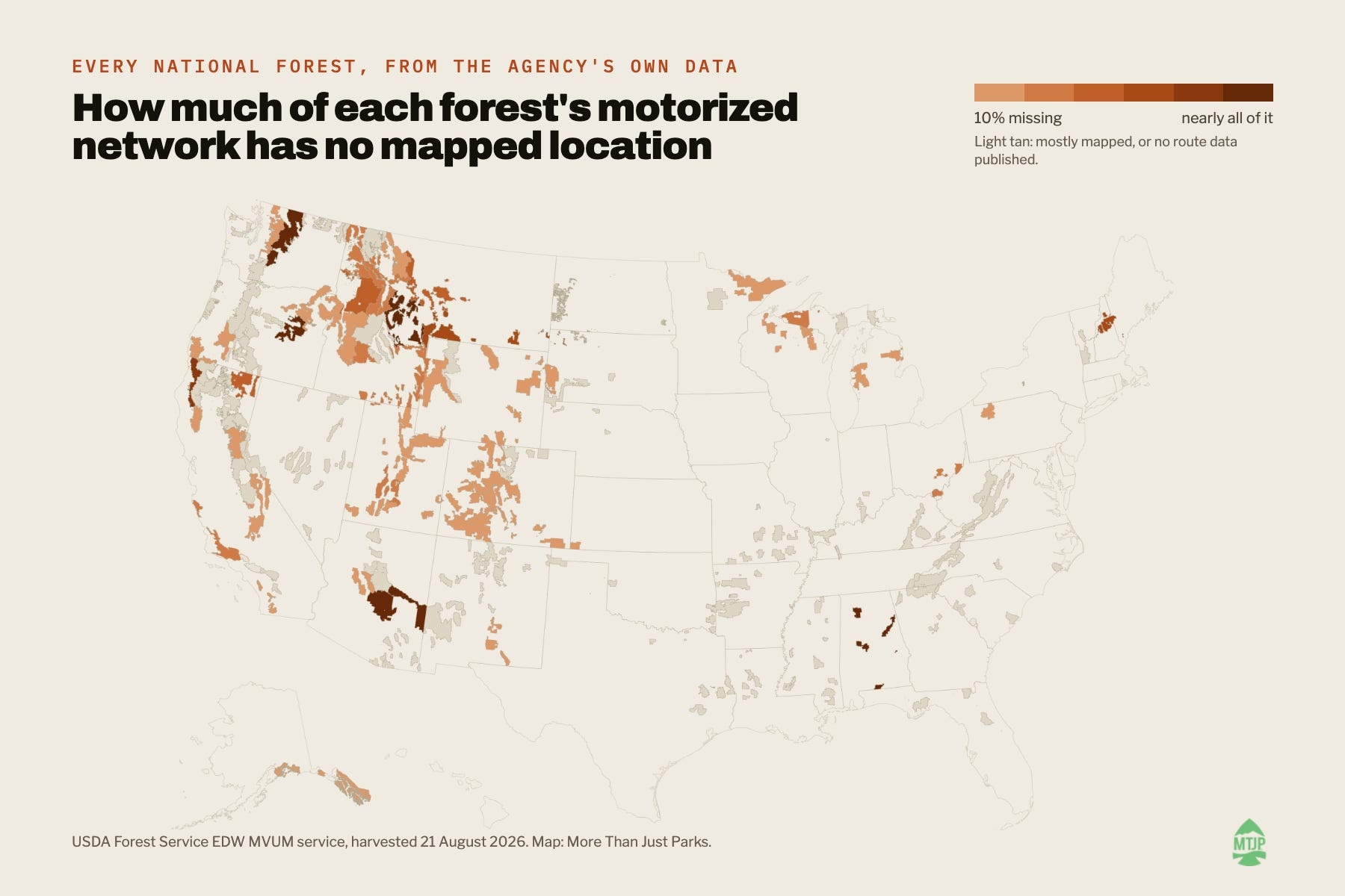
There are hundreds of thousands of miles of roads and motorized trails running through America’s national forests. And the rule behind all of it is being changed in a major way with a critical comment period ending Wednesday.
Until now, there hasn’t been one place where you could pull up the whole system, move from forest to forest, see which vehicles are allowed where, and inspect what the Forest Service’s own national data actually says about each route.
So we built one.
For the past several months, we’ve been pulling apart the Forest Service’s motor vehicle data, forest by forest, route by route, and assembling it into a single national map covering all 112 administrative national forest units.
Today, we’re opening the map up.
Search for a forest or an entire state. Zoom down to individual roads and trails. Switch between passenger cars, high-clearance vehicles, ATVs, motorcycles, side-by-sides, e-bikes and other vehicle classes. Open any forest and you’ll find its own map, its own rou…
