


For the past few years, something very strange has been happening all over America.
A town discovers its county commission voted on a data center project behind closed doors.
Residents somewhere else learn that a new transmission line is being planned to feed one.
Public officials have signed NDAs with the companies involved.
A project appears in county records under a name nobody recognizes.
A development authority starts acting less like a public body and more like an outside company’s local office, rushing land, tax breaks and infrastructure into place while growing openly hostile to the residents asking what’s going on.
Another community starts asking where the water will come from. Somewhere else, hundreds of acres change hands before anyone seems able to explain exactly what is being built there.
Then another project surfaces under a code name. Then another. And another.
By the time the public understands what’s happening, the deal is already far down the road.
From the ground, these can look like hundreds of separate local fights. Pull back far enough and they become something else entirely.
America is in the middle of an enormous industrial buildout, moving at extraordinary speed, with remarkably little public input or visibility.
And until now, there has been no accountability, no transparency, no public record that lets an ordinary person see what’s actually happening.
So we built one.
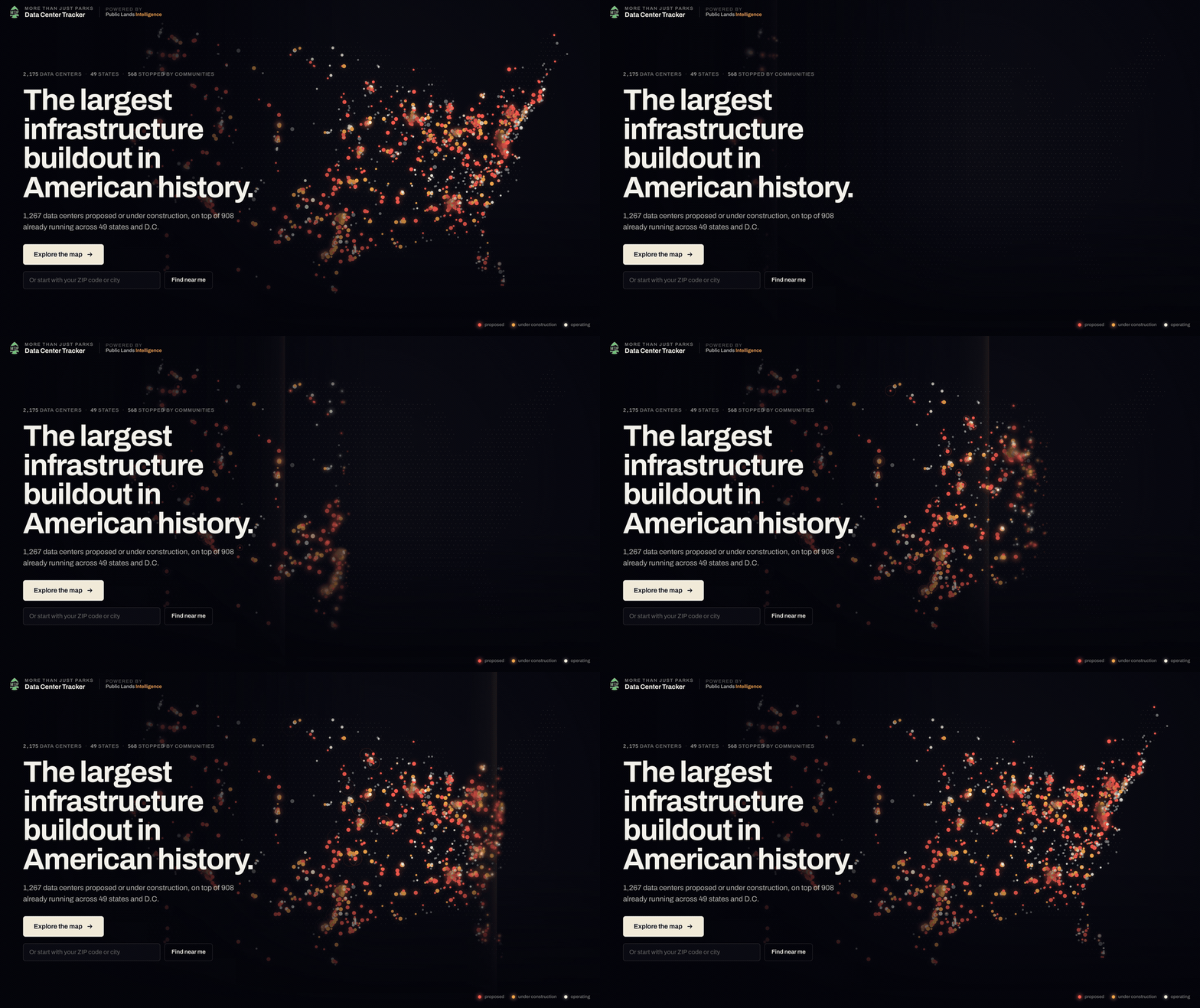
Today we’re launching the More Than Just Parks Data Center Tracker, one of the largest and most ambitious projects we’ve ever undertaken.
Why We Built This
More Than Just Parks is a public lands organization. We initially started this project with a much narrower goal to track where data centers were being proposed and built on America’s public lands.
But we quickly realized this story was far bigger than public lands. It was a story about communities all over America being asked to absorb an enormous industrial buildout they had little ability to see, understand or influence.
And the institutions that should have made that possible were not doing it.
People shouldn’t have to become amateur investigators just to understand what’s being built around them. They shouldn’t have to dig through utility filings, planning packets and shell-company names to figure out what their own governments already know.
They shouldn’t have to fight for basic information about projects that will reshape their communities, consume enormous amounts of water and electricity, and commit public resources for decades.
Yet that’s exactly what was happening.
We found that unacceptable. People deserve to know what is being built around them, who is behind it, what it will demand, and whether there is still time to have a say.
We had the tools and the ability to pull that scattered record together. And once we saw how badly it was needed, we felt an obligation to do it.
So we did.
What We Built
The More Than Just Parks Data Center Tracker is a living public record of the large-scale data center buildout happening across the United States.
It contains thousands of facilities and projects. Operating data centers. Campuses under construction. Projects still working their way through the approval process. And projects that communities have already stopped.
The map is only the front door. Open a project and you get its record, whatever we’ve been able to find. Who’s behind it. Where it is. What we know about its size. Whether it’s proposed, under construction or operating. The source that put it on the map. Satellite imagery. And, where we can establish it, the history of what has happened there. Commission hearings, tax deals, lawsuits, construction permits, votes, etc.
Every state has its own page too, so you can pull back and see what is happening across Virginia or Georgia or Arizona, then drill all the way down to one project in one county.
The point isn’t simply to show you where the buildings are. It’s to show you what is happening.
Start Where You Live

The easiest way into the whole thing is your ZIP code.
Type it in and the tracker shows you the data centers within 25 miles, starting with the closest.
You can see who’s behind them, which county they’re in, whether they’re proposed, under construction or operating, what we know about their size and which ones sit near protected public land.
Then try somewhere else you care about.
Your hometown. Where your parents live. The town outside a national park you visit every year. Somewhere you hunt or fish. A place you’ve been going since you were a kid.
You may find something you already knew about. You may find an operating facility you’ve driven past a hundred times without thinking much about it. Or you may find a project that is still only proposed.
That last category is why we cared so much about building this and releasing it as soon as we could.
Because proposed means there may still be something to decide.
Too often, the public finds out what is coming after the important decisions have already been made. We want people to be able to see it sooner.
And Then Keep Watching
Finding a project once is useful. Knowing what happens next is better.
So if there’s a place you care about, you can watch it. Set an alert for your ZIP code. Watch an entire state. Watch the country. Or follow one particular project.
Maybe there’s already a proposed campus down the road from your house. Maybe you’re following something near a wildlife refuge you love. Maybe you’ve spent the past six months showing up at county meetings over one project and want to know the next time something changes.
Open its page, hit Watch and we’ll keep checking it.
The tracker checks for changes every day and sends an email when there’s actually something new, whether a project is proposed, starts construction, changes status or gets stopped.
You shouldn’t have to spend every morning searching planning commission agendas and local news sites to figure out what happened overnight.
See Projects that Have Been Stopped

One decision we made early was that defeated projects would not disappear from the map.
If a proposal gets canceled, withdrawn, rejected or stopped by a moratorium, we keep it in the record.
Because that’s useful information. It tells you where communities pushed back. Where local officials changed course. Where a developer walked away. Where a project that once looked inevitable didn’t happen.
And when people in another county find themselves facing something similar six months later, that history may matter a great deal.
The data center buildout is not just a record of what companies managed to get away with. It should also be a record of where people said no.
A Public Lands Tracker Inside the Tracker
The push for data centers has already reached public lands, and there is every reason to expect much more of it.
The Public Lands page follows that fight on state and federal land.
It includes the 15 sites we’ve identified on publicly owned land, where those projects stand, upcoming decisions, federal notices, legislation and the latest reporting around these fights.

One proposed campus south of Boise covers roughly 3,200 acres of BLM land, with another 550 acres proposed for a transmission corridor.
Outside Boulder City, Nevada, BLM approved an 88.5-acre data center project 1.6 miles from Lake Mead National Recreation Area. That approval has since been challenged and the project is currently suspended.
There are other proposals involving public land in Arizona, Idaho, Nevada, Oregon and Utah, along with projects at federal Energy Department sites.
We’re going to spend much more time reporting on what all of this means for public lands in a separate piece.
For today, we want people to be able to see where it’s happening.
Pull Back and Look at the Country
It can be so easy to think about this as a proposal here, breaking ground over there, an angry town hall in another state. But look at this map and you’ll see that this is touching every part of America. Massive industrial projects that the public has had almost no say in are springing up like prairie dog holes in the Badlands.
Some states are saturated with sites, like Georgia, Virginia, Texas, and Ohio. Elsewhere, individual counties are inundated with projects.
And once you can finally see all of it in one place, the questions change.
Why are there so many in this county? Why does this company have so many in this state? Who approved this? Why are they clustered here? What utility is serving all of them? How much water are they using? What tax deals made this possible?
Those are much harder questions to ask when every project is buried in its own local filing or treated as a one-off development. The map makes the pattern visible.
And once you see the pattern, it becomes a lot harder to pretend these are isolated local projects with isolated local consequences.
We’re Going to Miss Things
Due to the nature of these projects, this record won’t be perfect.
Some projects first surface in obscure county filings. Others change names, developers, sizes or locations. Some are announced with almost no useful information. Others disappear without anybody bothering to announce that they’re gone.
And sometimes the person who drives past the site every morning knows something days before the rest of us do.
We’d like your help.
If there’s a data center near you that we’ve missed, tell us. If something on a page looks wrong or outdated, tell us. If you have a planning document, utility filing, hearing notice, lawsuit, local news story, photo, construction update or anything else we should know about a project already in the tracker, send it our way.
You can also add developments directly to a facility’s record. If there’s a hearing next week, a vote coming up, construction starting on the ground or a local group organizing around a project, let us know.
Once we can verify the source, we can add it.
This tracker will get better the more people use it.
A Quick Thank You
More Than Just Parks is still largely the two of us trying to build the kind of public lands work we think ought to exist.
Projects like this take an enormous amount of time, a serious amount of money out of our own pockets, and a hell of a lot of late nights, and a big reason we’re able to make them free for everyone because readers here choose to support our work.
If you’re a paid subscriber, thank you. We don’t take that support for granted.
And if you read us for free, use the tracker, share it, send us a tip, flag something we got wrong or pass it along to somebody who needs it. That helps too.
Thank you for giving us the chance to build things like this.
Where We Stand
We oppose the unchecked expansion of large-scale data centers that threaten American communities and natural resources.
Too often, these projects represent a corrupt bargain of socialized costs and privatized profits.
Communities are asked to absorb enormous new demands on electricity, water, land and infrastructure. Residents live with the noise, the lights and the transformed landscape. Ratepayers are exposed to costs created by extraordinary new loads. Governments offer tax breaks and other incentives.
The companies behind the projects keep the profits.
We think communities and the resources they depend on should come first.
We wrote an in-depth piece recently about a data center in Georgia that’s worth a read.
But this tracker is about something more fundamental than our position on the industry.
It’s about the public’s right to know.
Too much of this buildout has happened without even a basic level of visibility.
We built this to change that.
Until next time,
Will & Jim
Thank you from the bottom of my heart for doing this work and sharing it with all of us.
Thanks guys